2012年7月2日

ArcPad.BT.Identify 識別下拉清單

Identify 識別
Activate the Identify tool. 啓動識別工具

Measure 量度
Measure distances in the map view in point mode. 測量直線距離
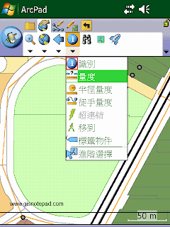
Step1 點選[量度]
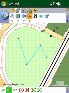
Step2 在地圖上用觸控筆點畫折線(polyline),按[繼續獲取屬性]。
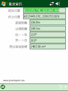
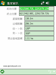
Step3 顯示剛才畫的折線起始與終止位置、距離和面積。
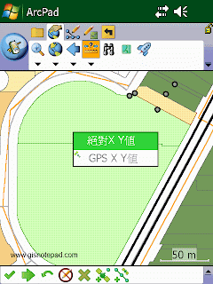
除了直接在地圖上畫線,也可以直接輸入坐標或抓取GPS的坐標。
例如:點選[絕對XY值]
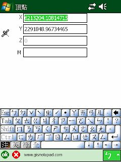
顯示頂點對話框,直接輸入XY值,按[OK]便可。

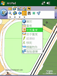
Radial Measure 半徑量度
Measure radial distances in the map view using the stylus. 測量半徑距離
Step1 點選[半徑量度]

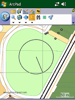
Step2 直接在地圖上畫圓

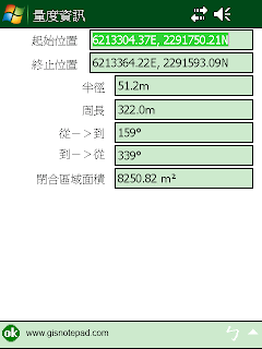
Step3 顯示圓的中心點和終點坐標、半徑、周長、面積等

Freehand Measure 徒手量度
Measure distances in the map view in freehand mode. 徒手畫線測量地圖距離
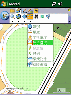
Step1 點選[徒手量度]

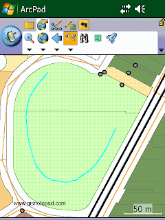
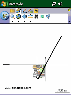
Step2 直接在地圖上畫任意線段

Step3 顯示線段起始與終止位置、距離和面積

Hyperlink 超連結
Activate the Hyperlink tool. 啓動超連結工具

Go To 移到
Activate line-of-sight or ArcLogistics™ navigation. 啓動視線或ArcLogistics導航

Label 標籤
Activate the Label tool. 啓動標籤工具

Advanced Select 進階選擇
Activate the Advanced Select tool. 啓動進階選擇工具


Reference to ESRI® ArcPad® 10 Quick Reference

2012年7月1日

ArcPad.BT.Go Back To Previous Extent 返回上一次範圍下拉清單

 Go Back To Previous Extent 返回上一個範圍
Zoom back to the previous extent you were using. 返回你上一次使用的地圖顯示範圍
  
Zoom back to the previous extent you were using
Step1 點選[返回上一個範圍]
Zoom back to the previous extent you were using
Step2 返回前一個視景
Go To Next Extent 移到下一個範圍
Zoom forward to the next extent in the extent history. 移到歷史紀錄中的下一次使用的地圖顯示範圍

Zoom forward to the next extent in the extent history
點選[移到下一個範圍]即可
Create Bookmark 建立書籤
Create a spatial bookmark. 建立空間書籤,紀錄不同視景範圍,方便使用者縮放地圖

Create a spatial bookmark
Step1 點選[建立書籤]
Create a spatial bookmark
Step2 可自訂書籤名稱、左下右上角點坐標,按[OK] 完成儲存。
Zoom To Bookmark 縮放至書籤範圍
Zoom to an existing spatial bookmark. 縮放至已儲存的空間書籤


Zoom to an existing spatial bookmark
點選[縮放至書籤範圍],顯示書籤清單,點選要使用的書籤名稱。


Reference to ESRI® ArcPad® 10 Quick Reference

ArcPad.BT.Zoom To Full Extent 縮放至整個範圍下拉清單

 Fixed Zoom In 固定放大
Zoom in from center of the map by 25%. 放大地圖25%
ArcPad 10-Fixed Zoom In
Step1 點選[固定放大]

ArcPad 10-Fixed Zoom In
Step2 地圖以視窗中央為中心,放大25%

Fixed Zoom out 固定縮小
Zoom out from center of the map by 25%. 縮小地圖25%
ArcPad 10-Fixed Zoom out
點選[固定縮小],可縮小地圖25%

Zoom To Selected 縮放至所選物件
Zoom to the extent of the selected feature. 縮放到所選物件的範圍
ArcPad 10-Zoom To Selected
Step1 先選取物件。例如選取地圖右下角1個電線桿(反藍處)

ArcPad 10-Zoom To Selected
Step2 點選[縮放至所選物件]

ArcPad 10-Zoom To Selected
Step3 地圖移動到以所選物件為中心,同時放大

Center On GPS 以GPS 位置居中
Center the map on the current GPS position. 將地圖中心移到目前GPS的位置
Step1 以[World]檔案為範例

Step2 點選[GPS已啟動]

Step3 GPS啟動並定位完成,地圖上顯示紅色十字絲及目前坐標。

Step4 點選[GPS居中]

Step5 地圖移動到以GPS定位點為中心

Zoom To Full Extent 縮放至全圖
Zoom to the full extent of the map. 縮放至地圖的整個範圍
ArcPad 10-Zoom To Full Extent
Step1 點選[縮放至全圖]

ArcPad 10-Zoom To Full Extent
Step2 地圖縮放至全圖範圍

Zoom To Layer 縮放至圖層
Zoom to the extent of a particular layer in the map. 縮放至地圖中特定圖層的範圍
AcrPad 10-Zoom To Layer
點選[縮放至圖層],顯示圖層清單。點選要定位
的圖層名稱,地圖縮放至該圖層全景範圍


Reference to ESRI® ArcPad® 10 Quick Reference