2012年7月8日

ArcPad.ET.POINT 繪畫點下拉清單

Point 繪畫點
Activate the point feature type for data capture. 啓動畫點功能獲取數據

Line 繪畫線條
Capture a straight-line feature using the stylus. 用筆獲取直線物件

Polyline 繪畫多折線
Activate the polyline feature type for data capture and start a new line feature. 啟動繪畫多折線模式獲取數據及新增線條物件

Freehand Line 徒手繪線條
Capture a freehand line feature using the stylus. 用筆獲取徒手繪畫線物件
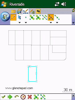
Rectangle 繪畫矩形
Capture a rectangle polygon feature using the stylus. 用筆獲取矩形物件

Polygon 繪畫多邊形
Activate the polygon feature type for data capture and start a new polygon feature. 啟動繪畫多邊形模式獲取數據及新增多邊形物件

Ellipse 繪畫橢圓形
Capture an ellipse polygon feature using the stylus. 用筆獲取橢圓形物件

Circle 繪畫圓形
Capture a circle polygon feature using the stylus. 用筆獲取圓形物件

Freehand Polygon 徒手繪畫多邊形
Capture a freehand polygon feature using the stylus. 用筆獲取徒手多邊形物件

Text Point 點文字
Capture a text feature relative to a point using the stylus. 用筆以點獲取文字

Text Polyline 線文字
Capture a text feature relative to a line using the stylus. 用筆以直線獲取文字

Text Polygon 多邊形文字
Capture a text feature relative to a polygon using the stylus. 用筆以多邊形獲取文字

Text Rectangle 長方形文字
Capture a text feature relative to a rectangle using the stylus. 用筆以長方形獲取文字

Text Ellipse 橢圓形文字
Capture a text feature relative to an ellipse using the stylus. 用筆以橢圓形獲取文字


Reference to ESRI® ArcPad® 10 Quick Reference

2012年7月7日

ImageChef 線上客製化影像網站

最近發現一個很實用又有趣的網站Image Chef,可以客製化自己要的影像檔。
英文官網
ImageChef官網除英文版本外,也支援中文和其他語言,但中文化不完整,只有部分文字有翻譯成中文,而且的另人看起來怪怪的,反而不了解它的意思,所以還是以英文版官網作為介紹。我們來作個簡單練習,點選[Browse Full Catalog]按鈕,顯示全部樣版分類。
中文官網
我們以比基尼泳褲作為示範,點選[Bikini Bottoms]
選擇你要的樣版
在文字方塊內輸入你要顯示的文字,這邊我們輸入KISS ME
輸入KISS ME
輸入完文字,按[Preview],比基尼辣妹泳褲上的文字由YOUR TEXT改成KISS ME了,很有趣 吧!
點選[Preview]預覽
修改完的圖片,可以按右鍵另存新檔,下面就是修改好的圖檔。
誘人的KISS ME !


ArcPad.ET.FEATURE PROPERTIES 屬性下拉清單


Feature Properties 物件屬性
Open the Feature Properties dialog box (or custom edit form) for the selected feature. 開啟所選物件的屬性對話盒或自定的編輯表格
Step1 要啟動編輯前,要先設定要編修的圖層

Step2 我們以[Parcel]圖層為例,點選使其成為編輯狀態(會出現一紅框)

Step3 用選取工具,點選一物件,使其反藍為作用中狀態。
Step4 點選[屬性]

Step5 屬性視窗有3個分頁,[Page1]分頁顯示所選取物件的屬性欄位

Step6 [地理]分頁顯示所選取物件的所有節點坐標及長度、面積。

Insert Vertices 加入頂點
Insert new vertices to the selected polyline or polygon. 在所選的多折線或多邊形加入新頂點
Step1 點選[加入頂點]

Step2 用觸控筆在反藍線條上點選,以新增節點

Append Vertices 貼上頂點
Add new vertices to the end, or tail, of the selected polyline. 在所選的多折線尾端加入新頂點

Move Feature 移動物件
Move the selected feature. 移動所選物件
Step1 點選[移動物件]

Step2 用觸控筆直接拖曳至目的地
Rotate Feature 旋轉物件
Rotate the selected polyline or polygon feature. 旋轉所選的多折線或多邊形
Step1 點選[旋轉物件]

Step2 觸控筆點選物件,再旋轉至所要的角度便可。

Scale Feature 縮放物件
Change the size of the selected polyline or polygon feature relative to the original size. 相對原本大小以改變所選的多折線或多邊形的大小
Step1 點選[縮放物件]

Step2 用觸控筆直接拖曳物件,以放大縮小

Resize Feature 物件大小
Change the size of the selected polyline or polygon feature. 改變所選的多折線或多邊形的大小
Step1 點選[物件大小]

Step2 選取的物件四周出現黑點,用觸控筆拖曳黑點改變大小

Delete Feature 刪除物件
Delete the selected feature. 刪除所選物件
Step1 點選[刪除]

Step2 出現[確認要刪除已選物件]對話框,如要刪除按[是],完成刪除動作。


Reference to ESRI® ArcPad® 10 Quick Reference

2012年7月6日

ArcPad.GPS POSITION WINDOW GPS 定位視窗

點選[GPS定位視窗]

GPS定位視窗顯示衛星、位置坐標及導航資訊有關的資訊,分為數據,衛星分佈,質素及調試4個分頁。
[數據]分頁

GPS坐標有以下不同坐標表示方式:
  • Map Projection (地圖投影座標系統)
  • DMS (dddºmm'ss.sss")
  • DMM (dddºmm.mmmm')
  • DD (dd.dddddddddº)
  • UTM (橫麥卡托投影座標系統)
  • WGS84 DMS (dddºmm'ss.sss")
  • WGS84 DMM (dddºmm.mmmm')
  • WGS84 DD (dd.dddddddddº)
  • MGRS (軍用方格座標)


GPS模式
  • NOFIX: 沒有位置
  • 2D: x,y 位置
  • 3D: x,y,z 位置
  • DGPS 2D/3D:差分定位
  • SBAS 2D/3D: 星基增強系統定位
  • RTK fix/flt: 即時動態定位(固定或浮動解)
  • PPS 2D/3D: 精確定位服務


Altitude高程
  • 高度(米或英尺)
  • 深度 (米或英尺)


[衛星分佈]分頁,顯示目前高空中的衛星位置,柱狀圖高低表示訊號強度,灰色表示訊號太低未採用。

[指南針]分頁,TCOG表示 真北航向。

[質素]分頁,顯示目前的GPS訊號精度

[調試]分頁,顯示目前接收到的GPS訊號

Reference to ESRI® ArcPad® 10 Quick Reference